THE BROOKLYN WATERFRONT
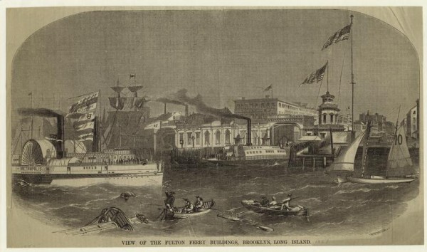
View of the Fulton Ferry buildings, Brooklyn, Long Island.” The Miriam and Ira D. Wallach Division of Art, Prints and Photographs: Picture Collection, The New York Public Library. The New York Public Library Digital Collections. 1857.
Shipping and Storage (19th Century)
The 1.3 mile stretch of waterfront where Brooklyn Bridge Park now sits was at one time a thriving center of commerce, industry, and transportation for Brooklyn and New York City before being opened as a public parkland in 2010. Alternately a beacon of progress and a symbol of neglect, the narrow strip of land has seen continuous change and redevelopment since the Dutch and English settlers arrived in the 17th century, displacing the Lenape Indians who once lived there. Due to it’s proximity to New York City, Brooklyn’s shore quickly became a bustling port, filled with produce and other goods from Long Island bound for the burgeoning city across the East River. The launch of Robert Fulton’s Steam Ferry service in 1814 further solidified the connection between the two then separate cities and, as Brooklyn residents began to make the 12 minute daily commute to Manhattan, it developed into the nation’s first suburb. In the mid-19th century, an influx of Irish and German immigrants nearly doubled Brooklyn’s population and provided a new labor source for the waterfront’s growing trade and storage industry. Furman street became lined with brick warehouses, such as the extant Tobacco and Empire Stores Warehouses, which contained goods from around the world including key imports including coffee and sugar. By the 1890s, the majority of the nation’s coffee supply came through the port, led by John Arbuckle, known as the Coffee King, who in 1871 opened a large roasting and packaging complex that revolutionized the way coffee was imported and distributed.
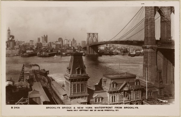
Brooklyn Bridge & New York waterfront from Brooklyn.” Irma and Paul Milstein Division of United States History, Local History and Genealogy, The New York Public Library. The New York Public Library Digital Collections, 1907.
Consolidation and Decay (1900 – 1950)
Near the turn of the century, the majority of independent warehouses, grain elevators, and storage facilities along the Brooklyn waterfront consolidated to form the The Brooklyn Wharf and Warehouse Company, which was incorporated in 1894. At the time, it became the largest private warehouse system in the world and received nearly all of the trade from South and Central America. In 1896, the company added a private rail system along the waterfront to expedite the dissemination of goods to the warehouses, piers, and shipping vessels, however, despite their infrastructure improvements, a sharp drop in the grain trade to Brooklyn led to the company’s sudden decline and takeover by The New York Dock Company in 1901. After taking over operations, The New York Dock Company launched a major redevelopment along the two and half mile stretch of waterfront south of the newly built Brooklyn Bridge, demolishing many of the existing warehouses and making necessary improvements to the piers and rail system. in 1913, plans were introduced to connect Brooklyn’s ports to the major New York rail lines through a marginal railroad in order to circumvent the cost of shipping imports to New Jersey for transport to inland destinations. This rail line, meant to run the length of the waterfront, would likely have become a reality despite resistance from local residents were it not for the dramatic increase in construction costs and the displacement of the labor force triggered by the outbreak of World War I.
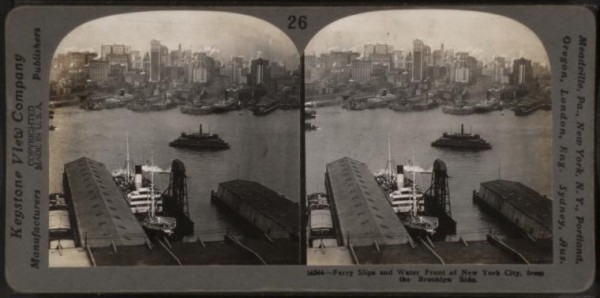
Ferry slips and water front of New York City, from the Brooklyn side.” The Miriam and Ira D. Wallach Division of Art, Prints and Photographs: Photography Collection, The New York Public Library. The New York Public Library Digital Collections.
NY/NJ Port Authority: 1950-1980
In 1955, unable to continue financing necessary infrastructure modernizations, the New York Dock Company sold over two miles of their Brooklyn waterfront property, including all piers, wharves and warehouses, to the Port Authority of New York and New Jersey for close to 14 million dollars. Stretching from the Brooklyn Bridge to the Erie basin, the transfer represented the largest in the history of the port and put the waterfront under state control. Shortly after the sale, the Port Authority began an extensive 85 million dollar, 7-year redevelopment project which saw 25 of the 26 existing piers demolished and replaced with ten new ones. Although it was anticipated that the improvements would create new jobs and lead to an influx of foreign trade, the containerization of the shipping industry continued to push most large cargo shipments to locations such as Newark and Port Elizabeth that could handle the massive steam ships and tankers. By the early 1980s, the waterfront lay mostly dormant and with the economic weight of maintaining the property mounting, including dire repairs needed to keep one of the piers from collapsing onto a subway tunnel below, Port Authority began looking for potential commercial and public uses for the land they had invested so heavily in.
Brooklyn Bridge Park: A fight for a new beginning (80s – present)
In 1988, Port Authority launched a request for proposals for the 55-acre Brooklyn waterfront site. After nearly selling the property to a commercial developer, local organizations began a push to reimagine the land, which for so long had been an industrial center, as public parkland for a borough desperately in need of green space. In 2000, Port Authority finally committed to using the land to create Brooklyn Bridge Park with the stipulation that the park would have to be self-sustaining after the initial development. In a unique arrangement between state and city organizations and private developers, a plan was agreed upon to jointly cover the capital cost of the $550 million dollar park construction, while the taxes from the private hotel and luxury residential units would be put towards the anticipated $15 million yearly maintenance costs of the park. Although September 11th and a subsequent economic recession threatened to derail the project, in 2004 Michael Van Valkenburgh Associates was hired to design the park and ground was broken four years later. In 2010, 9.5 acres of Pier 1 were competed and Brooklyn Bridge was opened to the public.
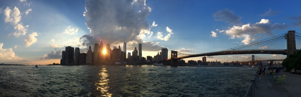
Merandy, Jesse. “View of Manhattan from Brooklyn Bridge Park.”